

Linear infrastructure such as pipelines, railways, power transmission lines, and highways covers vast geographic areas and requires continuous supervision to maintain safety and operational efficiency. Traditional inspection methods often face limitations, including high labor costs, difficult access to remote locations, and delayed responses to potential risks. As infrastructure networks continue to expand, organizations are increasingly exploring real-time monitoring systems to improve visibility and maintenance efficiency.
A modern monitoring architecture combines intelligent sensors, unmanned aerial systems, artificial intelligence, and advanced data processing capabilities. Icecypress Technology applies its expertise in 3D and AI-driven spatial intelligence to develop solutions that support real-time awareness, automated analysis, and efficient decision-making for complex environments. Its DroneSwarm Real-Time Onboard Analysis System demonstrates how drone data analytics can enhance infrastructure monitoring workflows.
Understanding the Architecture Behind Real-Time Monitoring Systems
Effective real-time monitoring systems require a coordinated architecture that connects data collection, processing, communication, and application layers. For linear infrastructure, this architecture must handle large-scale environments where conditions can change quickly and inspection demands are continuous.
The first layer focuses on data acquisition. UAV platforms equipped with advanced imaging and sensing technologies can collect information across extensive infrastructure corridors. Compared with manual inspections, drone-based collection provides faster coverage and enables operations in areas that are difficult or unsafe for personnel.
The second layer involves intelligent data processing. Instead of transferring massive amounts of raw information to centralized systems, edge computing technology allows data to be analyzed closer to the source. This reduces communication pressure and enables faster responses when abnormal situations are detected.
The final layer includes visualization, monitoring, and operational decision support. Through integrated software platforms, organizations can review infrastructure conditions, identify potential problems, and coordinate maintenance activities with greater accuracy.
How Drone Data Analytics Supports Infrastructure Monitoring
The increasing use of drone data analytics has transformed how organizations manage large-scale infrastructure assets. Drones can collect high-resolution images, geographic information, and environmental data, while AI algorithms help convert this information into meaningful insights.
For linear infrastructure management, drone data analytics enables automated recognition of structural changes, unusual conditions, and potential safety concerns. Instead of relying entirely on manual image reviews, AI-powered systems can identify important targets and provide location-based information for further evaluation.
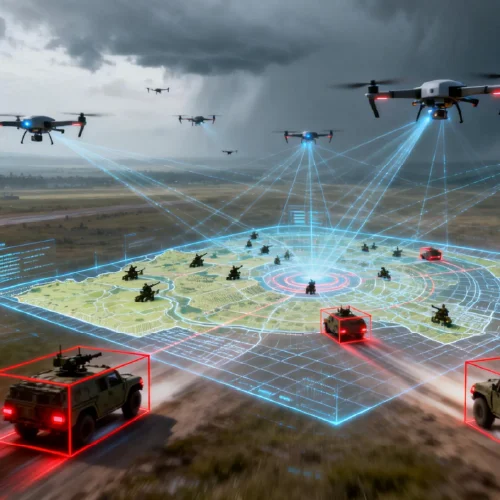
Icecypress Technology’s DroneSwarm system integrates edge intelligence with UAV cluster operations to support real-time 2D and 3D mapping. The system provides multi-UAV collaborative reconstruction, target recognition, positioning, and tracking capabilities, allowing teams to obtain valuable information during missions rather than waiting for post-processing.
This approach is particularly valuable for industries where rapid decisions are essential. Whether monitoring transportation networks, energy facilities, or large geographic areas, intelligent analysis helps organizations improve operational efficiency.
Multi-UAV Collaboration for Large-Scale Infrastructure Inspection
One of the major challenges of linear infrastructure monitoring is maintaining consistent coverage across extensive areas. A single drone may have limited flight time and operational range, making it difficult to complete complex missions efficiently.
Drone swarm technology provides a solution by enabling multiple UAVs to work together. Icecypress Technology’s DroneSwarm Real-Time Onboard Analysis System uses heterogeneous UAV collaboration to support coordinated missions. Different drone platforms can perform specific tasks while sharing operational information through unified command systems.
This architecture allows organizations to achieve faster mapping, enhanced target tracking, and more flexible mission planning. The system’s edge computing capability also reduces dependence on constant communication connections, making it suitable for remote areas where network conditions may be unstable.
For infrastructure operators, multi-UAV collaboration creates a more scalable monitoring approach. Large sections of pipelines, railways, or power lines can be inspected more efficiently while maintaining detailed situational awareness.
Applications of Real-Time Monitoring Systems Across Industries
The flexibility of advanced monitoring architecture allows real-time monitoring systems to support various industrial applications. Different sectors can utilize intelligent drone solutions according to their operational requirements.
For emergency response and rescue operations, DroneSwarm enables rapid disaster mapping, precise target localization, and continuous operation even in challenging communication environments. These capabilities help response teams understand conditions quickly and improve rescue coordination.
For large-scale surveying and GIS updates, the system provides centimeter-level collaborative mapping and dynamic geographic change monitoring. Automated updates support land surveys, urban planning, and infrastructure development projects.
Security surveillance and facility maintenance also benefit from intelligent UAV monitoring. Organizations managing power, oil, and gas facilities can use dynamic patrol functions, anomaly alerts, and high-precision 3D modeling to improve inspection accuracy and reduce operational risks.
The same technology can also support agricultural applications. By combining drone data analytics with large-area monitoring, agricultural organizations can collect information about farmland conditions and improve management strategies.
The Role of Edge Intelligence in Future Infrastructure Management
As infrastructure systems become more complex, traditional monitoring approaches may struggle to provide the speed and accuracy required by modern operations. Edge intelligence offers a new direction by allowing drones and connected devices to analyze information immediately during data collection.
Icecypress Technology focuses on developing independent core technologies in 3D and AI to build a strong digital foundation for spatial intelligence applications. Its DroneSwarm solution combines UAV collaboration, onboard computing, and intelligent analysis to create a more responsive monitoring framework.
For infrastructure managers, this means moving from periodic inspection models toward continuous awareness. Real-time information allows organizations to identify changes earlier, optimize maintenance schedules, and improve overall asset reliability.
Building Smarter Infrastructure Monitoring with Advanced Drone Solutions
The future of linear infrastructure management depends on technologies that can deliver accurate information quickly and efficiently. Real-time monitoring systems supported by AI, drone collaboration, and advanced analytics provide organizations with stronger capabilities for managing complex assets.
Icecypress Technology’s DroneSwarm architecture illustrates how drone data analytics and edge intelligence can improve inspection, mapping, and emergency response processes. By integrating data acquisition, intelligent processing, and operational applications, these solutions help organizations create more efficient and resilient infrastructure management strategies.

